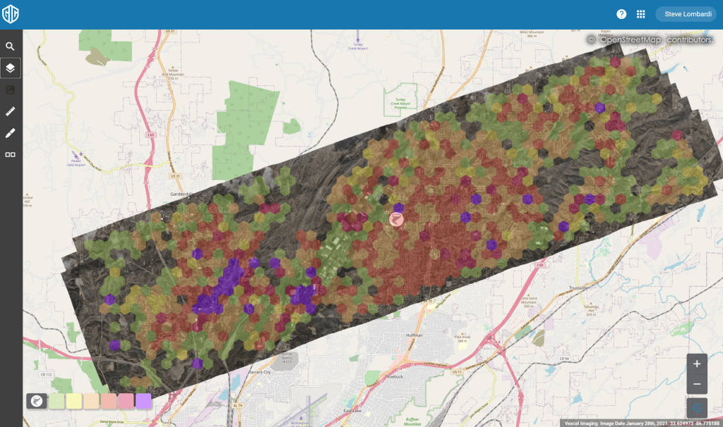
Aerial imagery over the area hit by this weeks tornado in Alabama is live on our platform. Just over 250 square kilometers of imagery, including 45 degree oblique imagery, has been published covering the northern Birmingham suburb of Fultondale. A computer vision generated heat map of the damage is also available to all GIC members in our web app.
Below is a screengrab showing the area flown with the heat map turned on. If your organization needs access to our web app, drop an email to support@gic.org with your request.